 lop News
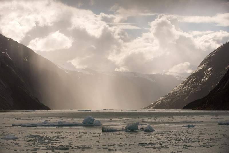
At 5:26 on an August morning, a mountainside collapsed into Tracy Arm Fjord in southeastern Alaska and produced a wave that climbed 481 meters up the opposite wall. That is taller than the Petronas Towers, taller than all but 14 buildings ever constructed, and second only to the 1958 Lituya Bay megatsunami among all waves ever recorded.
Nobody died. Almost nobody heard about it.
The silence was partly geography — Tracy Arm is remote, uninhabited, and the collapse happened before the day’s tour boats arrived. But it was also institutional. The slope that failed had not been flagged as a risk. The only landslide site continuously monitored by the federal US Geological Survey in Alaska is Barry Arm, 60 miles east of Anchorage. Others in the area are checked periodically from satellites or aircraft. And federal monitoring capacity in Alaska shrank last year when the Trump administration’s budget cuts reduced the teams watching for these hazards, particularly in heavily visited national parks, according to CNN.
The study, published in Science and led by University of Calgary geomorphologist Daniel Shugar, reconstructs what happened. Over decades, the South Sawyer Glacier had been thinning and retreating. Then, in the spring of 2025 alone, it pulled back roughly 500 meters. Between August 2 and August 5 — days before the collapse — the glacier retreated past the exact spot where the mountainside would give way.
Shugar compared the mechanism to a buttress on a cathedral: the glacier held the valley walls in place while it was there. Remove it, and everything those walls were holding back comes down. “As that glacier retreated over the last few decades, it retreated just past the spot that did fail,” he said.
The landslide dropped roughly 165 million metric tons of rock one kilometer vertically into the fjord. The resulting wave was colossal but brief — over in roughly 45 seconds to a minute, according to tsunami modeler Patrick Lynett of the University of Southern California. Unlike earthquake-driven tsunamis that push walls of water inland for half an hour, landslide tsunamis are enormous splashes in confined spaces. The fjord’s steep, narrow geometry concentrated the energy straight up.
A quiet morning, a crowded afternoon
Tracy Arm is a popular stop on Alaska’s cruise circuit. More than 20 boats visit daily in summer, including ships carrying up to 6,000 passengers and crew. Annual Alaska cruise passenger numbers rose from roughly 1 million in 2016 to 1.6 million in 2025, according to the study. A National Geographic tour vessel was already heading toward the glacier when the collapse occurred, roughly 15 miles away. Its captain, Thomas Morin, later wrote that “All of the curves of the fjord up near the glacier must have reduced the height of the wave and force just enough, though still very powerful, which is probably why we are still floating and not smashed into the wall of the fjord.”
Hours later, a sightseeing vessel from Juneau and another National Geographic tour boat — each carrying more than 100 passengers — were scheduled to enter the fjord. The day before, two large cruise ships carrying thousands had visited.
Dennis Staley of the US Geological Survey told The Guardian: “I feel like we dodged a bullet.” At least three major cruise lines have since suspended Tracy Arm routes for 2026.
Slopes in motion
What troubles researchers most is that nobody saw this coming. Bretwood Higman, a geologist who has spent years mapping landslide risks across Alaska, said he had examined Tracy Arm specifically and found no warning signs — no visible deformation, no creeping slope. Even looking back with hindsight after the event, experts could not identify the typical precursors.
“That we were all caught off guard says a lot about these hazards,” said research seismologist Ezgi Karasozen of the Alaska Earthquake Center, a co-author on the study. “We should be acting more quickly.”
Karasozen and her colleagues are exploring a color-coded warning system: rapid glacier retreat plus heavy rain could trigger a yellow alert; adding consistent seismic tremors from an unstable slope could escalate it. The data suggests such signals might have provided a full day’s warning at Tracy Arm — enough time to clear boats from the area.
Whether such a system gets built is another matter. Alaska has thousands of miles of coastline and more than 1,000 mapped slow-moving landslides. The frequency of catastrophic failures appears to be climbing. Higman noted that these events occurred roughly once every 20 years over the past two centuries. In the most recent decade, there were six.
“I think that pattern is real,” he said.
Sources
- The Forensics of a Skyscraper-Sized Tsunami — Eos (AGU)
- Alaska’s 2025 mega tsunami highlights risk to cruise lines as climate crisis fuels glacier retreat — The Guardian
- Ride a jet ski through a re-creation of an Alaska mega-tsunami — CNN
- ‘We should be acting more quickly’: Tracy Arm tsunami highlights unseen hazards in busy Alaska fjords — Alaska Public Media
Discussion (9)