 lop News
Fifteen months of advance warning. A potentially “super” El Niño building in the Pacific. And 2026 on track to be the second-warmest year humans have ever recorded.
Researchers at the University of Hawai’i at Mānoa have developed a forecasting model that predicts El Niño and La Niña conditions up to 15 months ahead. The model, called Wyrtki-CSLIM, needs just two inputs: sea surface height in the equatorial Pacific and global sea surface temperature. No supercomputers required.
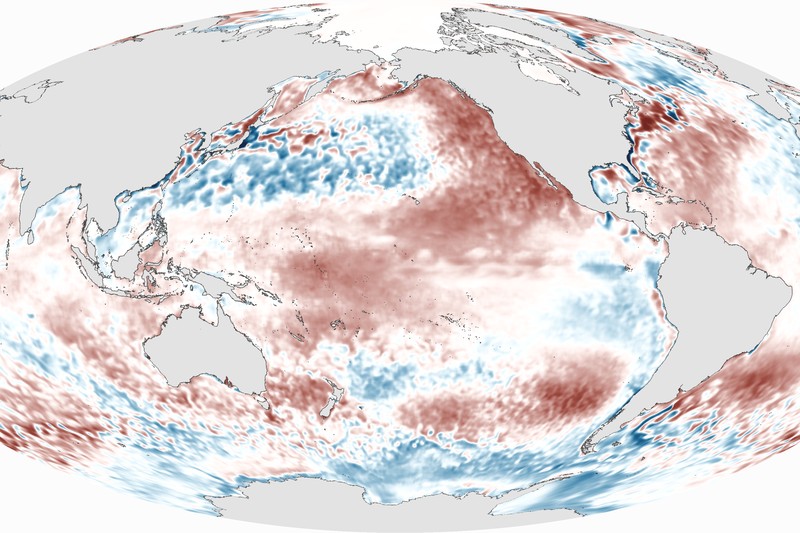
Its first real-world prediction: a strong El Niño, with eastern Pacific temperatures more than 2°C above normal, developing toward the end of this year.
That lines up with what other models are showing. An April 21 analysis by Carbon Brief found the median estimate from 637 model runs across 13 forecasting groups puts the Niño3.4 temperature anomaly at 2.2°C by September — squarely in “super El Niño” territory.
A simpler crystal ball
The Wyrtki-CSLIM model, detailed in Geophysical Research Letters on April 14, draws on climate science fundamentals dating back decades. Oceanographer Klaus Wyrtki showed in the 1960s that sea level changes reveal heat accumulating in the tropical Pacific. Nobel laureate Klaus Hasselmann demonstrated that the ocean retains a “memory” of past conditions through large-scale temperature patterns. The Hawai’i team wove both principles into a single empirical model and tested it against six decades of historical data.
The result: forecasting skill comparable to — and sometimes better than — complex dynamical models and AI-based approaches.
Yuxin Wang, lead author and postdoctoral researcher at the UH Sea Level Center, said the approach achieves ENSO forecast skill “comparable to, and in some cases better than, many of today’s more complex climate models and leading AI-based approaches.”
A model this cheap and transparent could make seasonal forecasting accessible to nations without supercomputing resources, though co-author Matthew Widlansky cautioned that “all models have uncertainties, and the climate impacts of each El Niño event are different.”
The heat already here
The forecast lands against a backdrop of near-record warmth. The first three months of 2026 were the fourth-warmest start to any year on record across datasets from NASA, NOAA, the Met Office Hadley Centre, Berkeley Earth, and Copernicus. That persistence is notable: weak La Niña conditions early in the year typically suppress global temperatures.
Carbon Brief estimates 2026 will finish with global temperatures between 1.37°C and 1.58°C above pre-industrial levels, with a best estimate of 1.47°C — a 62% chance of ranking as the second-warmest year on record and a 19% chance of surpassing 2024 as the warmest.
Arctic sea ice tied 2025 for the lowest winter peak in the satellite record: 14.29 million square kilometres on March 15, according to the US National Snow and Ice Data Center.
Seeing it clearly
There is a grim symmetry at work. Scientists have achieved genuine progress in predicting the most consequential climate oscillation on Earth, and the immediate reward is a clearer view of what’s coming.
The UK Met Office said on April 15 that “this could be the strongest El Niño event so far this century.” Columbia University’s International Research Institute gives a 94% probability that El Niño conditions persist through year’s end.
A super El Niño — sea surface temperatures exceeding 2°C above normal — has only materialized a few times since 1950. The 2015 event brought severe drought to Ethiopia, water shortages in Puerto Rico, and a punishing Pacific hurricane season, according to US federal scientists. The pattern typically produces drought and heat across Australia, southern Africa, India, and the Amazon, with heavy rainfall in the southern US, the Middle East, and south-central Asia.
Advance warning saves lives — it lets governments stockpile food, reinforce infrastructure, and shift agricultural planning before drought or flooding hits. But the underlying data is unambiguous about the trend. El Niño amplifies warmth; it doesn’t create it. The baseline keeps climbing.
If a strong or super El Niño develops this year, the worst temperature effects will likely land in 2027, consistent with the historical pattern where the year following an El Niño peak sets the global record — as in 1998, 2016, and 2024.
For now, 2026 is still writing itself. The models say it will be hot. The Pacific is about to make it hotter.
Sources
- Simple ocean-based model forecasts El Niño skillfully, points to a strong event ahead — University of Hawai’i at Mānoa SOEST
- State of the climate: Strong El Niño puts 2026 on track for second-warmest year — Carbon Brief
- What is a ‘super El Niño’ and what might it mean for the global climate? — The Guardian
Discussion (10)